News Archive
- Workshop 'Analysis of changes in land uses and covers in Catalonia (2002-2007 and 2007-2012)'
-
Last Tuesday May 29 took place, in the Auditorium of the Secretariat of Environment and Sustainability, the presentation workshop of the Analysis of changes in uses and land cover in Catalonia 2002-2007 and 2007-2012. This is a presentation of a work carried out by Grumets during the year 2017, which presented the results and analysis of the changes in the uses and land cover in Catalonia in the periods 2002-2007 and 2007-2012 and the study of rates and accelerations of change in the period 1987-2012.

The study, based on the consolidated change techniques of Serra, Pons and Saurí (2003), has shown that from 1987 to 2012 the area occupied by urban areas and roads has grown steadily, with an average speed of 3610 ha / year, very high considering the relatively small starting surface; the growth has been produced mainly from crops (60%) and soils with little or no vegetation (19%) in the period 2002-2007 and from crops (43%) and gain to marine waters (23%) in the period 2007-2012. The forest areas have also grown, mainly from scrubs and meadows (between 87 and 88%) at a slightly lower rate (3268 ha / year) and with a great irregularity between years due mainly to the fact that they are one of the covers most affected by forest fires, with years with great impact such as 1994 (94701 ha), 1998 (26286 ha) or 2012 (17512 ha). On the other hand, agricultural surfaces are clean and almost constant surface donor areas, with an average of -6296 ha / year over these 25 years; in particular, they are mainly converted into scrubs and meadows (68% in 2002-2007 and 62% in 2007-2012) or in soils with little or no vegetation (3% in 2002-2007 and 12% in 2007-2012). In the five-year period from 2007 to 2012, a paralysis of the dynamics of territorial transformation has been verified, fruit of the strong economic crisis, which has led to the fact that 97% of the territory has not suffered any variation.
The bases of the entire series of 25 years of data in five-year maps (1987 to 2012) are available in free access on the web http://territori.gencat.cat/ca/01_departament/12_cartografia_i_toponimia/bases_cartografiques/medi_ambient_i_sostenibilitat/bases_miramon/territori / map-dusos-i-cobertes-del-sol. On this website, in addition to being distributed in ZIP files containing TIFF files, metadata files, etc., they are also distributed in the open MMZX format of MiraMon. You can consult here the Workshop program.
-
30-05-2018
- Grumets leads one of the WeObserve Communities of Practice on interoperability
-
The WeObserve project, with the participation of Grumets, is planning to launch its first 3 Communities of Practice on June 6 in Geneva in the framework of the Citizen Science Workshop Day of the 2nd ECSA International Conference (European Citizen Science Association).

The WeObserve CoPs will serve as the vehicle for sharing information and knowledge on selected key thematic topics related to Citizen Observatories (COs), strengthening the knowledge base about COs in order to move citizen science into the mainstream of environmental management and decision making.
In total, WeObserve will develop five CoPs over the course of the project. Each CoP will receive support and tools for managing the CoP activities (online and F2F) and undertaking dissemination and outreach. The CoPs will exist for as long as they provide value to their members, with WeObserve support to draw on for the coming 2 ½ years.
The first three CoPs will be launched this year on the Citizen Science Workshop Day on 6 June 2018. They have the following topics:
-
1) Co-creating citizen observatories and engaging citizens – addressing incentives and barriers for participation, engagement strategies and citizen-science ethics (led by IHE Delft)
-
2) Impact and value of citizen observatories for governance – defining socio-economic and environmental impacts of community-based environmental monitoring for public authorities and decision makers including risk evaluation (led by IHE Delft)
-
3) Interoperability and standards for citizen observatories – adopting data quality, curation and preservation of citizen-science data, and addressing privacy and licensing for CO sustainability (led by CREAF)
CoP3 is led by Grumets and will consist of an Interoperability Experiment developed under the umbrella of Open Geospatial Consortium (OGC). The Experiment has the direct support of Joint Research Centre (JRC), CREAF and International Institute for Applied Systems Analysis (IIASA).
The CoPs are intended as a key mechanism to consolidate knowledge on COs inside as well as beyond the WeObserve consortium. As such, a wide range of stakeholders is invited to take part in the CoPs, such as public authorities (local, regional, national, EU), civil society organisations, research and academia, citizens and citizen science working groups. Activities that the CoPs will undertake include thematic knowledge co-creation, generating new solutions or agreeing on how to use existing ones, and knowledge sharing activities (meetings, events, conferences).
Related links:
More information on the launch
Program of the Citizen Science Workshop Day
Registering to the Communities of Practice (CoPs)
Terms of reference for the Communities of Practice (CoPs)
-
23-05-2018
- Second update of the Remote Sensing Terminology Dictionary
-
Recently, the second update of the Remote Sensing Terminology Dictionary, published on paper in 2012 (with Enciclopèdia Catalana and the Cartographic and Geological Institute of Catalonia) and prepared by Xavier Pons and Anna Arcalís with the linguistic collaboration of Termcat, has been released online. Following the publication on paper, an open access publication was made through Termcat, which was updated some time ago. Now a new update of this version is presented, which includes 48 new terms and 171 modifications. Currently the Dictionary offers 2214 Catalan terms with the equivalents in Spanish and English, plus the corresponding synonyms, which means that there are more than 3000 entries.
It is the most extensive Dictionary (with more entries and with more complete entries) never published in any language on Remote Sensing. With the new update, the Dictionary is well up to date with platforms and sensors that are continually being launched, and also those that are phasing out. The Dictionary is another contribution to the dissemination of science in Catalan, and in this case it is quite deep, given the following characteristics:
- More than 3000 entries with synonyms, 2214 entries with described content.
- It is not a simple vocabulary where there are terms or a dictionary with very brief descriptions to know what we are talking about, but without going into detail: it is an authentic dictionary with an almost encyclopedic vocation, in which the definitions are as long as convenient; this means that, on the one hand, it serves as a reference tool of matter to students and professionals and on the other hand, serves to make a very intense use of the Catalan terminology, which allows to discover not well resolved issues during its drafting.
- It contains technical information not available in other remote sensing works (such as spatial resolution at the lateral ends of the images, which is often forgotten to be much more modest than in the central part and this has important implications when doing research or applications with satellite data) compiled in a consistent and rigorous manner.
The Dictionary is available from the following link: http://www.termcat.cat/ca/Diccionaris_En_Linia/197/. In the introduction to the paper version of the Dictionary you can find other virtues of the work described. We hope it will be useful to you.
-
13-04-2018
- 3rd prize of the Orleans / OGC Inspire Hackathon for the work of Grumets
-
The third prize of the OGC Inspire Hackathon that took place this Thursday March 22 in Orleans under the INSPIRE Conference has been for the map browser developed by Grumets within the EcoPotential project. The browser incorporates the geospatial user feedback, also developed by Grumets in the NextGEOSS project. Double recognition, therefore, for the work done, congratulations!
-
23-03-2018
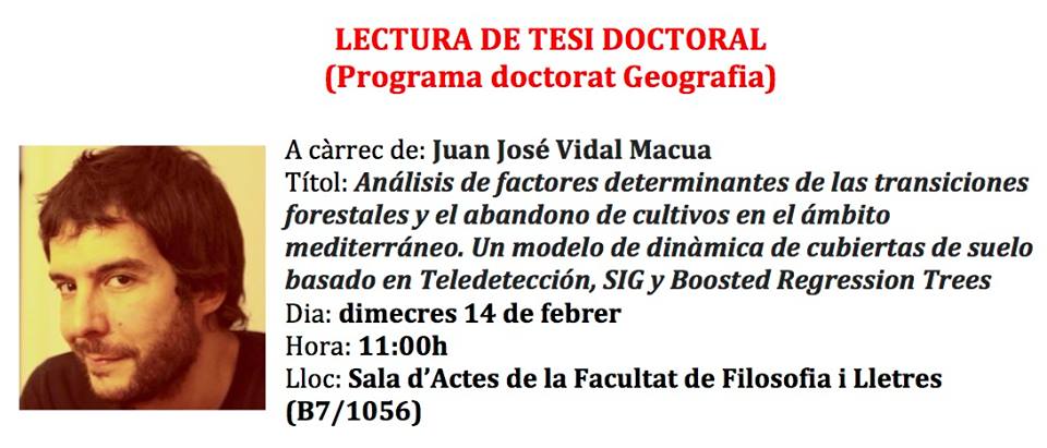
- PhD thesis defense by Juanjo Vidal
-
On Wednesday February 14 at 11 a.m., the defense of the PhD thesis of the Grumet Juanjo Vidal-Macua will take place in the Hall of the Faculty of Arts and Humanities of the UAB. The thesis has been directed by the Grumets Xavier Pons, Miquel Ninyerola and Alaitz Zabala and is titled Analysis of determining factors of forest transitions and the abandonment of crops in the Mediterranean. A model of land cover dynamics based on Remote Sensing, GIS and Boosted Regression Trees.
13-02-2018
- Participation of Grumets in the conference TerraEnVision
-
Grumets Joan Cristian Padró and Xavier Pons attended the conference TerraEnVision - Environmental Issues Today: Scientific Solutions for Societal Issues last February 1st to present the work Evaluation of mine restorations using UAV imagery, by Padró JC, Carabassa V, Balagué J, Alcañiz JM and Pons X. The conference took place in Barcelona.

12-02-2018
- Good New Year for Grumets
-
This newly released 2018 year begins well for Grumets, who start with a handful of new publications on the curriculum. A book and four indexed articles collect the recent work of Grumets in the fields of remote sensing and conservation of natural resources, the dynamics and ecology of the landscape, the modeling of energy fluxes and the geometric and radiometric corrections of satellite images. Here you have the references and the access to the works to enjoy them during this 2018:
- Díaz-Delgado R, Lucas R, Hurford C (eds.) (2017) The Roles of Remote Sensing in Nature Conservation. A Practical Guide and Case Studies. Springer International Publishing. Ed. 1, XII, 318 pp. DOI: 10.1007/978-3-319-64332-8. Ebook ISBN: 978-3-319-64332-8. Hardcover ISBN: 978-3-319-64330-4.
- Vidal-Macua JJ, Ninyerola M, Zabala A, Domingo-Marimon C, Gonzalez-Guerrero O, Pons X (2018) Environmental and socioeconomic factors of abandonment of rainfed and irrigated crops in northeast Spain. Applied Geography 90: 155-174. DOI: 10.1016/j.apgeog.2017.12.005. https://doi.org/10.1016/j.apgeog.2017.12.005.
- Padró JC, Pons X, Aragonés D, Díaz-Delgado R, García D, Bustamante J, Pesquer L, Domingo-Marimon C, González-Guerrero O, Cristóbal J, Doktor D, Lange M (2017) Radiometric Correction of Simultaneously Acquired Landsat-7/Landsat-8 and Sentinel-2A Imagery Using Pseudoinvariant Areas (PIA): Contributing to the Landsat Time Series Legacy. Remote Sensing 9 (12): 1319. DOI: 10.3390/rs9121319. http://dx.doi.org/10.3390/rs9121319.
- Mira M, Ninyerola M, Batalla M, Pesquer L, Pons X (2017) Improving Mean Minimum and Maximum Month-to-Month Air Temperature Surfaces Using Satellite-Derived Land Surface Temperature. Remote Sensing 9(12): 1313. DOI: 10.3390/rs9121313. http://dx.doi.org/10.3390/rs9121313.
- Zambon I, Serra P, Grigoriadis E, Carlucci M, Salvati L (2017) Emerging urban centrality: an entropy-based indicator of polycentric development and economic growth. Land Use Policy 68: 365-371. DOI: 10.1016/j.landusepol.2017.07.063. https://doi.org/10.1016/j.landusepol.2017.07.063
10-01-2018